MAPS:
|

|
BASIC INFO:
- Total area: 1.267 million sq km
- Land area: 1,266,700 sq km
- Water area:300 sq km
- Size comparative to U.S. territory: slightly smaller than twice the size of Texas
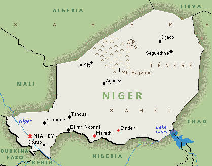
- shared borders of Countries/bodies of water: Algeria 956 km, Benin 266 km, Burkina Faso 628 km, Chad 1,175 km, Libya 354 km, Mali 821 km, Nigeria 1,497 km
- Total distance of all land boundaries: 5,697 km
- Total distance of coastline: 0 km, the country is landlocked
- Climate: desert; mostly hot, dry, dusty; tropical in extreme south
- Terrain: predominately desert plains and sand dunes; flat to rolling plains in south; hills in north
- lowest point of elevation: Niger River 200 m
- highest point of elevation: Idoukal-n-Taghes 2,022 m
- Land area: 1,266,700 sq km
- Water area:300 sq km
- Size comparative to U.S. territory: slightly smaller than twice the size of Texas
- shared borders of Countries/bodies of water: Algeria 956 km, Benin 266 km, Burkina Faso 628 km, Chad 1,175 km, Libya 354 km, Mali 821 km, Nigeria 1,497 km
- Total distance of all land boundaries: 5,697 km
- Total distance of coastline: 0 km, the country is landlocked
- Climate: desert; mostly hot, dry, dusty; tropical in extreme south
- Terrain: predominately desert plains and sand dunes; flat to rolling plains in south; hills in north
- lowest point of elevation: Niger River 200 m
- highest point of elevation: Idoukal-n-Taghes 2,022 m
